December 6, 2015
My last day on the Parkway with
only 55 miles to go and I’m just a little sad so I’m dragging my heels a bit.
I’ve so enjoyed the Parkway. It’s an absolutely wonderful combination of
driving slow, stopping often, learning about geology, native history, early
American history, and just plain taking it easy. It’s tourism at its’ best and
many, many kudos to the National Park Service for getting it right! If this is
what I can expect in other national parks I can’t wait.
The road is in excellent
condition, the washrooms, camp areas and all the stops have been in impeccable
condition. I’ve not seen less than at least 3 maintenance staff a day whether
at stops along the way or on the roadside cleaning up after some less than
stellar fellow travelers. I only saw one mess that needed attention and when I
reported it to a worker at my next stop, she got right on her radio to report
it to someone.
I’d recommend travelling the
parkway for anyone and especially for families. It’s a living history and
geography lesson all rolled in to some great travel.
 |
| Section of Old Trace in Rocky Springs Camp |
First off though, some time spent in Rocky Springs Park. Easily accessible from the camping area is a mile long section of the old Trace which takes you almost to the extinct town of Rocky Springs.
All that’s left of a thriving town of 2,616 in 1860 is a couple of cisterns and 2 old safes.
 | |||
| Cistern in Rocky Springs town site |
 |
| Old Safe remains |
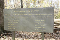
Grindstone Ford and another section of really sunken trace followed. In spots the old Trace is as deep as 20’ below surrounding land. And to think it was all worn away by thousands of feet and a lot of wagons. Of course, mother nature had some help in it too. The soil is very light and sustainable trail building wasn’t part of the plan back then!
 |
| Grindstone Ford Sign |
 | |
| Gravestones at Grindstone Ford |
Mount Locust is the only stand (inn) still remaining on the trace. Again, the NPS has done a marvelous job of restoring the property and the building.
 | ||
| Mount Locust |
A very interesting contrast between the family cemetery and the slave cemetery.
 | |
| Slave Cemetery |
 | |
| Family Cemetery |
Down the road just a little way is a very visual display of the type of soil typical to the region. It’s no wonder that the Trace is worn so deep.
 |
| Loess Soil Erosion |
Emerald Mounds are just spectacular. It’s the second largest temple mound in the US, second only to one in Illinois. Carved out of a natural hill by the Mississipians, ancestors to the Natchez Indians 400 to 700 years ago, it supported temples, ceremonial structures and burials for a very complex religious belief.
 |
| Mound at the top of the hill |
 | |
| A long way down! |

And in closing, a stop at the Southern Terminus for a picture.
 |
| Natchez Trace Parkway Southern Terminus |
A very short drive and I was
parked under some nice shade trees in, what else, a W/M parking lot.

No comments:
Post a Comment